
An independently researched Plymouth walking guide
6 of the best dog walks in Plymouth
Six checked dog walks in and around Plymouth, from a one-mile woodland loop to the full waterfront and a moorland challenge, with exact starts, official routes and current dog rules.
Researched by Pet Storybook Details verified 22 September 2026

Start here
Which Plymouth dog walk fits today?
Six published routes worth planning properly
Each choice is a bounded manager-published route. The profiles separate the exact Google Maps arrival from the route instructions, then set out distance, ground, parking, facilities and the lead rules that matter.
Plymouth gives you city promenade, estuary, woodland, coast and Dartmoor-edge ground within one chooser. Carry water and a lead, open the live manager page before leaving, and let closures, livestock and signs on the day override this checked guide.
Stonehouse to Jennycliff A full city waterfront day
Plymouth Waterfront Walkway

- Distance
- 9.3 miles (14.9km) one way
- Time
- Not stated by the route manager
- Ground
- Mostly pavement, with cobbles, hills, steps and steeper ground between Laira Bridge and Mount Batten
- Start
- Admiral's Hard ferry slip, Stonehouse, Plymouth PL1 3RJ
The route
Follow Plymouth's signed Waterfront Walkway east from Admiral's Hard, through Royal William Yard, the Hoe and Barbican, around Sutton Harbour and across Laira Bridge to Mount Batten and Jennycliff. This is a one-way route, so choose a shorter signed section or plan the return before starting.
Open the official Waterfront WalkwayWhat dog owners need to know
The city dog control order allows off-lead walking in open spaces and on the foreshore outside signed exclusions and lead zones. Pick up waste, carry bags and put your dog on a lead when an authorised officer requires it. Busy streets, shared promenades and local signs make a lead the sensible default through crowded sections.
Before you go
The route manager lists parking near both ends but does not promise toilets or drinking water across the full route. The current Cremyll Ferry operator says well-behaved dogs travel free and confirms service from Admiral’s Hard, subject to weather, tides and circumstances.
Watch for: This is a long one-way walk with cobbles, road crossings, steps and steep sections. Check the live ferry notice and do not treat the listed distance as a return journey.
Plympton An easy wooded circuit
Plymbridge and Plym Valley woodland wander
- Distance
- 1 mile (1.6km)
- Time
- 30 to 40 minutes
- Ground
- Mainly flat woodland paths, one flight of uneven steps and possible mud after rain
- Start
- Plymbridge Woods car park, grid reference SX524585
The route
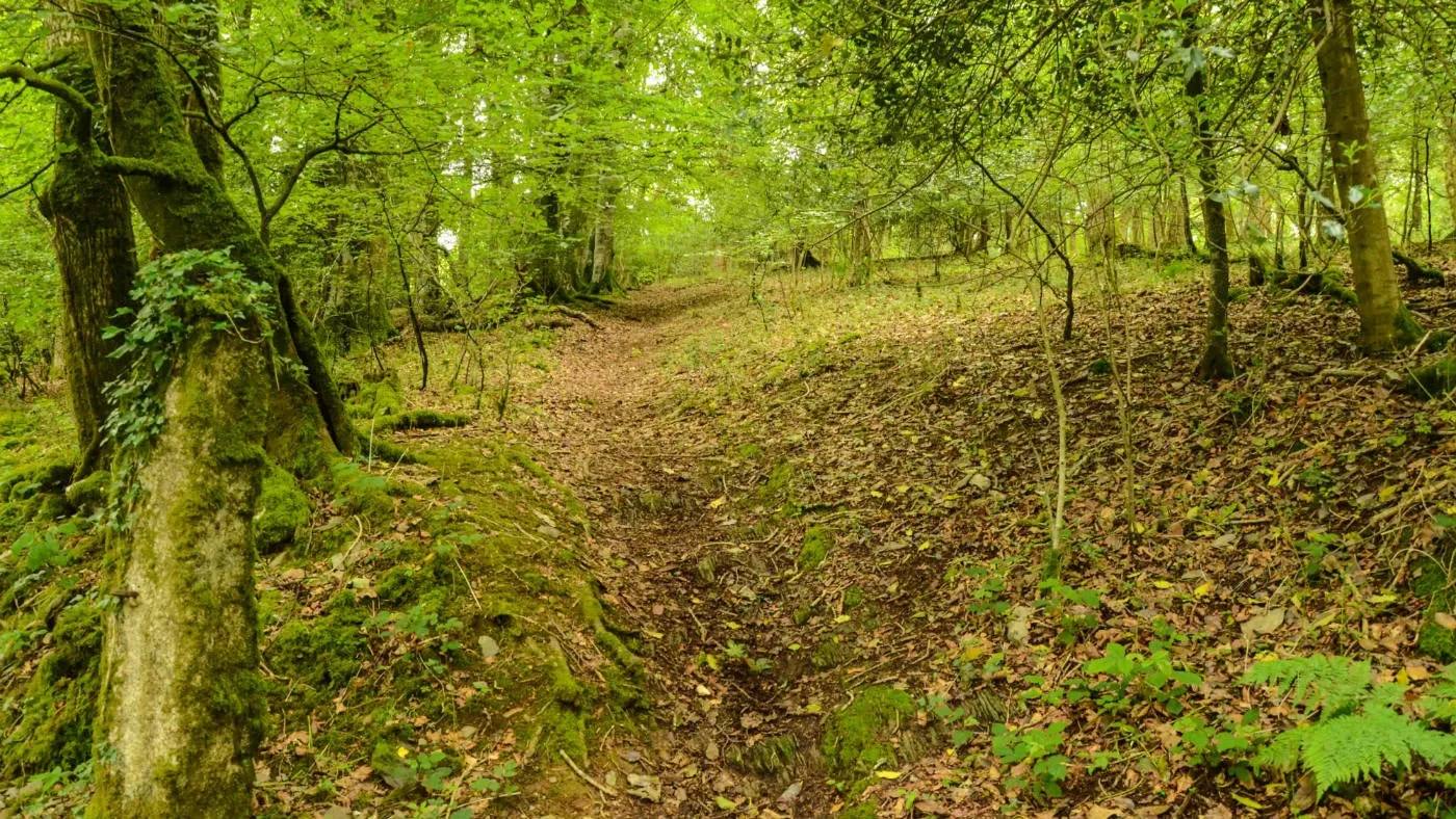
Follow the National Trust’s eight-stage circular route through ancient woodland, past canal and railway remains and beneath Cann Quarry viaduct, then return to Plymbridge Woods car park.
Open the official woodland wanderWhat dog owners need to know
Dogs may be off lead under close control in much of the parkland and woods, with leads required in signed areas and around livestock or wildlife. Close control means first-call recall, remaining visible and not approaching other people or dogs without consent. Peregrines breed here from March to July.
Before you go
The route starts at the National Trust car park. The manager does not promise toilets, refreshments or drinking water at this trailhead, so plan facilities and bring dog water.
Watch for: One flight of steps is uneven and the path can become muddy. Follow temporary wildlife signs during the peregrine breeding season.
Saltram A short estate circuit with facilities
Saltram Pillars Walk
- Distance
- 1 mile (1.6km)
- Time
- 30 to 40 minutes
- Ground
- Parkland and woodland tracks with some slopes, tarmac and possible mud
- Start
- Saltram House car park, grid reference SX520556, Plymouth PL7 1UH
The route
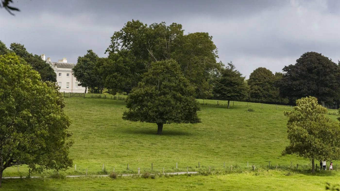
Follow the official six-stage circuit from Saltram House car park through the park and woods, passing the amphitheatre, the eighteenth-century castle folly and the avenue before returning to the house.
Open the official Saltram Pillars WalkWhat dog owners need to know
Use a lead in the car park and stableyard and close control across the park. Saltram East permits off-lead walking under close control from April to August while sheep are away. Red signed areas require leads from September to March. Ordinary dogs cannot enter the house.
Before you go
The park and car park are open dawn to dusk in the current live table. Saltram lists toilets, adapted toilets, cafes, water bowls near the stables and 11 dog-waste bins. Building and facility hours vary by date.
Watch for: Sheep movements change which fields are lead-only. Read the red signs on arrival, even if the seasonal summary suggests off-lead access.
Wembury Sea views on a compact route
Wembury Point short walk
- Distance
- 1.9 miles (3.04km) circular
- Time
- 40 minutes to 1 hour 30 minutes
- Ground
- Tarmac and coast path with steep climbs and possible mud after wet weather
- Start
- Wembury Point car park, grid reference SX503487, Plymouth PL9 0BA
The route
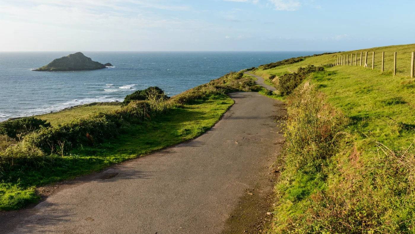
Take the National Trust route from Wembury Point car park along the old military road and coast path, with views towards Plymouth Sound and Great Mewstone. Complete the 1.9-mile circuit or use the manager’s 1.2-mile out-and-back option.
Open the official Wembury Point short walkWhat dog owners need to know
Dogs are welcome but must stay on a lead because Dartmoor ponies graze the headland. The rocky foreshore is protected for marine life, birds, insects and plants. Take dog waste home because there are no dog bins.
Before you go
Parking is small and very limited, and the manager discourages roadside parking. Nearby refreshments are at Wembury Beach and Heybrook Bay, not at this trailhead. No toilet or drinking-water point is promised.
Watch for: Expect steep climbs and mud after rain. The manager coordinate is the reliable arrival because a broad car-park search returns several nearby choices.
Shaugh Prior A challenging moor and woodland route
Cadover Bridge and Dewerstone Rock circular

- Distance
- 3.4 miles (5.44km)
- Time
- About 2 hours 30 minutes
- Ground
- Steep, rocky, uneven and muddy paths with steps, gates and stiles
- Start
- Cadover Bridge car park, grid reference SX554645, Plymouth PL7 5EH
The route
Follow the National Trust’s nine-stage circuit from Cadover Bridge beside the River Plym, through woodland around Dewerstone Rock and across open moorland before returning to the car park.
Open the official Cadover and Dewerstone routeWhat dog owners need to know
Fit and energetic dogs are welcome. Keep them under close control around livestock and on a lead from 1 April to 31 July.
Before you go
The route starts and ends at Cadover Bridge car park. The manager does not promise toilets, refreshments or drinking water, so arrive self-sufficient and check moorland conditions.
Watch for: This route is graded challenging and includes steep rocky ground, mud, gates and stiles. Keep the seasonal lead period in mind when planning.
Mount Edgcumbe A ferry-side historic landscape circuit
A Seat with a View, Mount Edgcumbe
- Distance
- 4 miles (6.5km)
- Time
- Not stated by the route manager
- Ground
- A country-park circuit through a managed historic landscape; the manager does not publish a difficulty grade
- Start
- Mount Edgcumbe Barrow Centre, Torpoint PL10 1HZ
The route
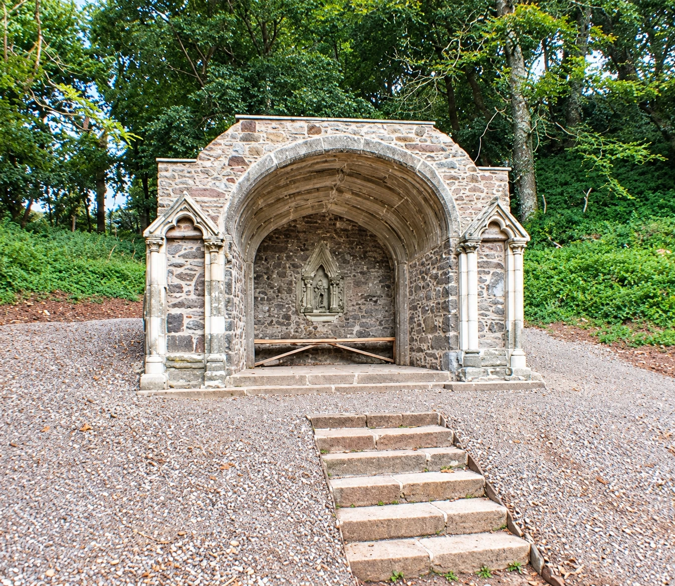
Use the park manager’s named trail and downloadable leaflet for a four-mile circuit starting and finishing at the Barrow Park Centre. It links viewpoints and historic seats around the Mount Edgcumbe estate.
Open the official A Seat with a View routeWhat dog owners need to know
Dogs are welcome but must remain under control at all times across the country park. Follow local signs and any livestock instructions on the day.
Before you go
The country park is free and opens daily year-round, 8am to 8pm in summer and 8am to 6pm in winter. Free toilets are listed at the Barrow Centre and four other park points. The current Cremyll Ferry carries well-behaved dogs free.
Watch for: The route page and leaflet are older, although the live manager site still links them. Check current park notices and ferry status before travelling from Plymouth.
Parking, closures and seasonal access
Planning your Plymouth dog walk
Use the exact named arrival rather than a broad postcode, download the manager route before leaving signal and carry dog water. The Waterfront Walkway is one way, Wembury parking is very limited, and the Mount Edgcumbe ferry remains subject to weather, tides and operating notices. Across Plymouth, signed exclusions and lead zones override the general dog-control framework.
Plymouth City Council dog control
The useful short answers
Before you choose a Plymouth dog walk
Which Plymouth dog walk is shortest?
Plymbridge woodland wander and Saltram Pillars Walk are both one mile and graded easy. Plymbridge has one uneven flight of steps, while Saltram has slopes, tarmac and possible mud but lists the strongest facilities.
Can dogs be off lead on these walks?
Plymbridge allows off-lead walking under close control in much of the woods outside signed lead areas. Saltram East permits it from April to August while sheep are away. Plymouth’s wider public-space rule still defers to signed exclusions, lead zones and authorised-officer directions.
Which routes require a lead?
Wembury Point requires leads because ponies graze the headland. Cadover requires a lead from 1 April to 31 July and close control around livestock. Saltram uses signed lead areas and seasonal field rules, while city signs can require leads on the Waterfront Walkway.
Which walk is best for a longer day?
The Plymouth Waterfront Walkway is longest at 9.3 miles one way and needs a return plan. Cadover is only 3.4 miles but takes about two and a half hours because its steep, rocky ground is graded challenging.
Can dogs use the Cremyll Ferry?
The current operator says well-behaved dogs travel free. Services are subject to weather, tide and circumstances, so check the live ferry page before relying on it for Mount Edgcumbe or a Waterfront Walkway plan.
How current is this guide?
Every route, arrival and dog rule was checked against the relevant managing body on 22 September 2026. Temporary closures, livestock, ferry notices and signed restrictions can change faster than editorial copy, so live sources and signs remain the final authority.
Help keep this guide useful
Is something wrong?
Dog rules, closures and access can change. Tell us what you spotted and we will check it against the latest official source before changing the guide.