
An independently researched Cardiff walking guide
6 of the best dog walks in Cardiff
Six properly sourced dog walks in and around Cardiff, from a short farmland circuit to a 9.5-mile city-to-forest route, with exact starts, official maps and the dog rules that matter.
Researched by Pet Storybook Details verified 17 September 2026

Start here
Which Cardiff dog walk fits today?
Six published routes worth planning properly
These are bounded, published routes rather than broad park suggestions. Every profile separates the exact Maps arrival from the managing body’s route and states terrain, parking, facilities, livestock and wildlife limits.
Cardiff changes quickly from waterfront paths to farmland and forest. Carry water and a lead, plan the return for linear walks, check the live manager page before setting out, and let current signs override general advice here.
Cardiff Bay and Penarth A long, mostly level waterside circuit
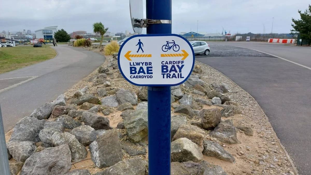
Cardiff Bay Trail
- Distance
- 6.2 miles (10km)
- Time
- Not stated by the route manager
- Ground
- Mostly level surfaced paths, with shared walking and cycling sections and short on-road stretches
- Start
- Norwegian Church Arts Centre on Harbour Drive
The route
Start beside the Norwegian Church, where the official map marks the start and finish. Follow the signed loop around the Bay, cross Cardiff Bay Barrage and Pont y Werin, continue through Penarth and return to Harbour Drive.
Open the official Cardiff Bay TrailWhat dog owners need to know
Keep your dog under control and clear up after them. Use a short lead around cyclists, crowds and road sections. Swimming in Cardiff Bay is prohibited, so keep dogs out of the water and follow every safety sign.
Before you go
Harbour Drive pay and display parking is beside the start. The official route map marks toilets and Changing Places facilities around the circuit. No public dog drinking-water point is promised, so carry water.
Watch for: This is a busy shared trail with road crossings and open water. Give cyclists room and keep dogs away from the Bay edge.
Tongwynlais Woodland sculpture, history and a moderate loop
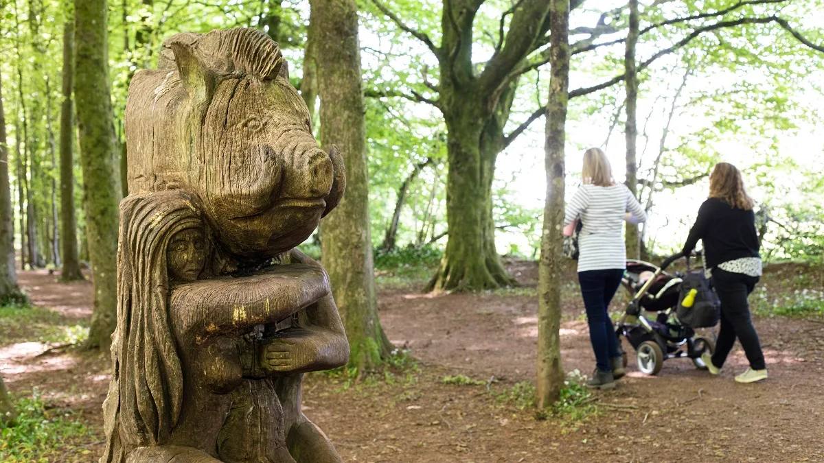
Fforest Fawr Sir Henry’s Trail
- Distance
- 2.4 miles (3.9km)
- Time
- About 2 hours
- Ground
- Moderate forest paths that can be muddy, with climbs between the two car parks
- Start
- Fforest Fawr car park, CF83 1NG
The route
Follow the current Sir Henry’s Trail waymarkers from Fforest Fawr car park. The circular route links Fforest Fawr and Castell Coch car parks, passes woodland sculpture and gives a fenced view of former mine workings before returning to the start.
Open the official Sir Henry’s TrailWhat dog owners need to know
Keep your dog under effective control, use a short lead when needed and prevent chasing livestock or wildlife. Follow site signs on the shared paths. Ordinary dogs cannot enter Castell Coch, where only assistance dogs are admitted.
Before you go
Parking at Fforest Fawr is free and overnight parking is not allowed. The manager does not promise toilets or drinking water at the forest car park, so arrive self-contained.
Watch for: Forest paths can be muddy. The former mine workings are unsafe and must be viewed from behind the fence.
St Fagans A short signed circuit with museum facilities
St Fagans Circular Walk
- Distance
- Just under 2 miles (3km)
- Time
- 45 minutes to 1 hour 30 minutes
- Ground
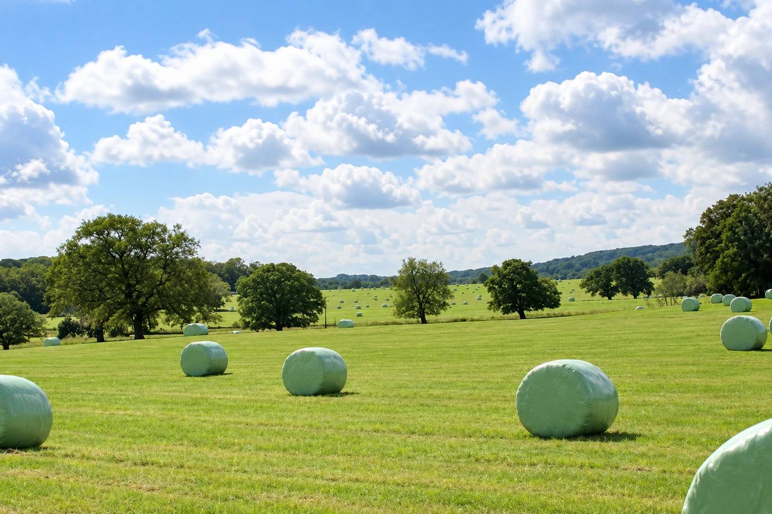
- Mostly flat farmland with gentle slopes, one kissing gate, three stiles and a roadside-verge section
- Start
- St Fagans National Museum of History car park
The route
From the museum car park, use the official approach to the red-banded waymarked circuit. The route crosses farmland used for grazing, passes St Mary’s Church and returns through the village to the museum.
Open the official St Fagans Circular WalkWhat dog owners need to know
Use a short lead around grazing animals. Within the museum grounds, dogs must stay on a short non-extendable lead and cannot enter historic buildings, galleries or cafes. The farmyard is closed to dogs during lambing from February to April.
Before you go
Museum parking currently costs £7 per day and is free for Blue Badge holders and motorbikes. Toilets, accessible toilets, water bowls and food are available during museum opening, currently 10am to 5pm daily except Christmas.
Watch for: The route has three stiles, a kissing gate, grazing stock and a roadside-verge section. Museum rules apply whenever you enter its grounds.
Rumney A compact river and wildlife corridor loop
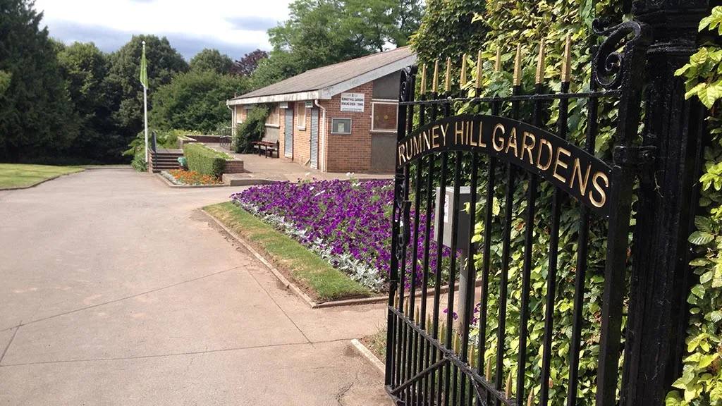
Rhymney Trail, Rumney Hill circular
- Distance
- 2.2 miles (3.6km)
- Time
- Not stated by the route manager
- Ground
- Park paths, river embankment, quiet streets and playing fields, with a steep final slope
- Start
- Rumney Hill Gardens park entrance
The route
Follow the signed 3.6km circuit from Rumney Hill Gardens down to the river embankment. The route uses Ball Lane, Ball Road and Hartland Road, crosses Rumney Playing Fields and climbs the steep slope back into the park. Starting at Ball Lane avoids that final slope.
Open the official Rhymney TrailWhat dog owners need to know
Keep your dog under control and clear up after them. The trail is shared with cyclists and crosses reed bed, meadow and a wildlife corridor, so keep dogs close and use a short lead when signs or other users require it.
Before you go
Rumney Hill Gardens is open 24 hours and has parking at the entrance. The manager lists no public toilets and promises no drinking-water facility, so carry water.
Watch for: The return to Rumney Hill Gardens is steep. Choose the Ball Lane start described by the manager if that climb is unsuitable.
Grangemoor to St Fagans A long river route with a current diversion
Ely Trail from Grangemoor
- Distance
- 7 miles (11.2km) one way
- Time
- Not stated by the route manager
- Ground
- Mostly traffic-free shared paths, with a short on-road section and a signed temporary road diversion
- Start
- Dunleavy Drive beside Grangemoor Park
The route
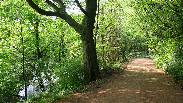
Join the Ely Trail on Dunleavy Drive beside Grangemoor Park and follow the river north towards St Fagans. The current Paper Mill diversion uses quiet roads past Victoria Park and Waun-gron Road station before rejoining the trail behind Landwade Close.
Open the official Ely TrailWhat dog owners need to know
Keep dogs under control on the shared trail, use a short lead beside roads and cyclists, and prevent chasing wildlife. The river corridor supports waterfowl and otters. Museum short-lead rules apply only if you enter St Fagans grounds at the finish.
Before you go
The manager does not promise dedicated parking, toilets or drinking water at the Dunleavy Drive start. It says parking is available at several points along the trail. Museum facilities at the finish are available only during opening hours.
Watch for: This is a one-way route. Plan a return before starting and follow the live Paper Mill diversion rather than an older mapped line.
City centre to Fforest Ganol A full linear day from castle to forest
Cardiff section of the Cambrian Way
- Distance
- 9.5 miles (15.2km) one way
- Time
- Not stated by the route manager
- Ground
- Riverside, canal and forest paths with city road sections; much of the route is shared with cyclists
- Start
- In front of Cardiff Castle on Castle Street
The route
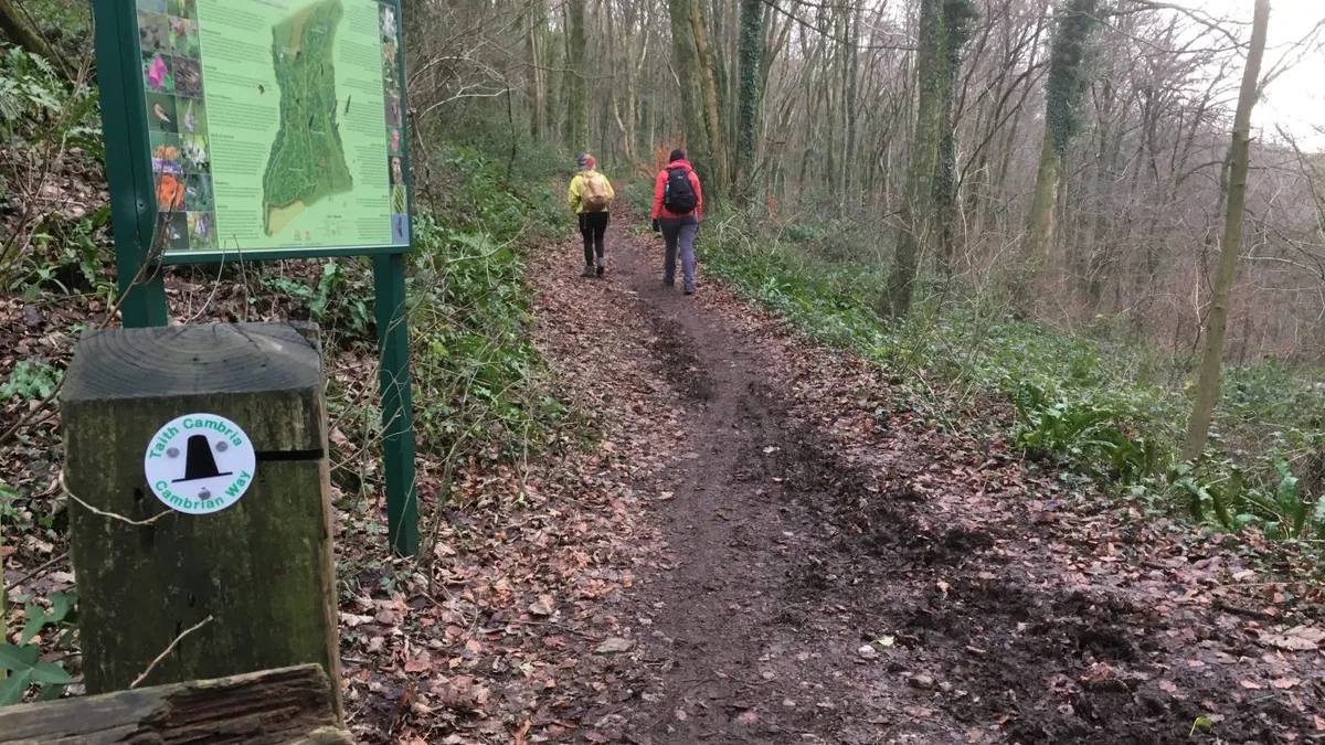
Start in front of Cardiff Castle and follow the official 9.5-mile section north beside the River Taff. The route passes the Glamorgan Canal, Castell Coch, Fforest Fawr and Fforest Ganol, then ends at the A469 by the Travellers Rest.
Open the official Cardiff Cambrian Way routeWhat dog owners need to know
Keep dogs under control, clear up after them and use a short lead around traffic, cyclists, livestock or wildlife. Follow all site signs. Ordinary dogs cannot enter Castell Coch.
Before you go
Cardiff Castle has no on-site parking and lists nearby paid car parks. Outdoor Cardiff suggests returning by bus from the Travellers Rest. Toilets and drinking water are not promised for the whole route, so plan both before leaving.
Watch for: This is a long one-way walk rather than a loop. Check bus times, daylight, path conditions and live access notices before committing.
Parking, closures and seasonal access
Planning your Cardiff dog walk
The Ely Trail has a current Paper Mill diversion, the two longest routes are one way, and farmland or forest conditions can change after rain. Open the live manager page on the day, arrive at the named start rather than a broad postcode, save the official directions offline and plan your return before leaving.
The useful short answers
Before you choose a Cardiff dog walk
Which Cardiff dog walk is easiest underfoot?
Cardiff Bay Trail is the clearest mostly level, surfaced choice, but it is 6.2 miles and includes shared paths, road sections and crossings. Rumney Hill is much shorter, though its return slope is steep unless you start at Ball Lane.
Can dogs be off lead on these walks?
None of the route managers gives a blanket off-lead promise for an entire walk. Keep effective control, carry a lead and use it around traffic, cyclists, livestock, wildlife or wherever signs require. St Fagans Museum requires a short non-extendable lead in its grounds.
Which Cardiff route works for a short dog walk?
St Fagans is just under two miles and Rumney Hill is 2.2 miles. St Fagans includes stiles, grazing land and a roadside verge, while Rumney Hill has a steep slope unless you use the manager’s Ball Lane alternative start.
Which walk is best for a longer day?
The Cardiff section of the Cambrian Way is 9.5 miles one way from Cardiff Castle to the A469 by the Travellers Rest. The Ely Trail is seven miles one way. Both need a return plan before you set out.
Which route has the most useful facilities?
St Fagans has toilets, accessible toilets, water bowls and food during museum opening, currently 10am to 5pm daily except Christmas. Cardiff Bay’s official map marks toilets and Changing Places facilities around its circuit. Carry water on every route.
How current is this guide?
Every route, arrival and dog rule was checked against its managing body on 17 September 2026. Temporary diversions, livestock and path conditions can change faster than editorial copy, so official pages and signs remain the final authority.
Help keep this guide useful
Is something wrong?
Dog rules, closures and access can change. Tell us what you spotted and we will check it against the latest official source before changing the guide.